Drone mosaic correction
homonim can be used to correct any orthorectified multi-spectral imagery. This case study demonstrates the correction of a drone ortho-mosaic.
Correction
A 5 cm resolution, RGB ortho-mosaic was obtained from Open Aerial Map. The image covers a complex, heterogeneous area. Correction was performed with a Sentinel-2 reference, the gain_blk_offset model, and a kernel shape of 3 x 3 pixels. Of the tested settings, these produced the best evaluation results.
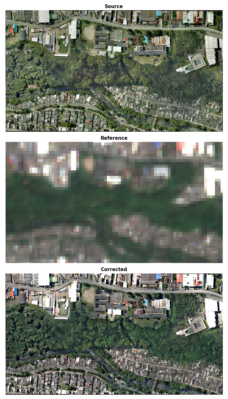
Source, reference & corrected images
While the corrected and reference colours are similar, improvement in surface reflectance is less obvious in this figure than e.g. the aerial mosaic case study. Quantitative results in the next section give a clearer indication of the surface reflectance accuracy.
Evaluation
The source and corrected drone images were compared with a second, Landsat-8 reference to evaluate the change in surface reflectance accuracy. The scatter plots below show a meaningful improvement in correlation with the reference after correction.
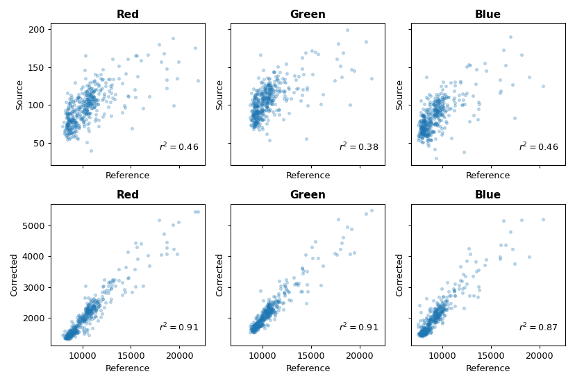
Source & corrected - reference comparison
Note
The figures in this case study are generated by the drone correction tutorial.
The ortho-image was obtained from Open Aerial Map under the CC BY 4.0 license.