homonim
Correct drone, aerial and satellite imagery to surface reflectance.
Description
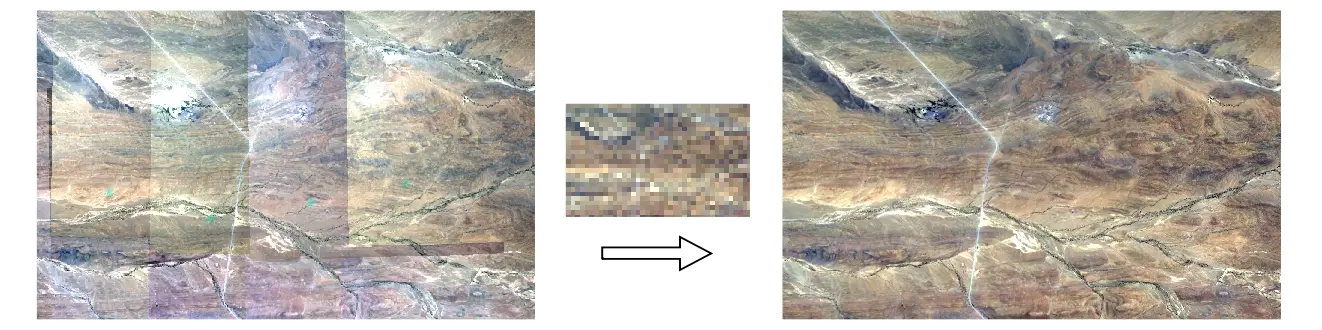
homonim provides a command line interface and API for correcting remotely sensed imagery to approximate surface reflectance. It implements a form of spectral harmonisation, that adjusts for spatially varying atmospheric and anisotropic (BRDF) effects, by fusion with satellite surface reflectance data. Manual reflectance measurements and target placements are not required.
homonim is useful for pre-processing in quantitative mapping applications, and for reducing seamlines and other visual artefacts in image mosaics. It can be applied to multi-spectral drone, aerial and satellite imagery. The consistency of multi-temporal and multi-sensor data can improved through its use.
Technical details of the method can be found in the paper on which it is based.
Installation
homonim is available as a python 3 package, via pip or conda.
pip
pip install homonim
conda
conda install -c conda-forge homonim